Cedar River Watershed Project: Lower Cedar Preserve
By Taylor on February 26, 2013 in Blog
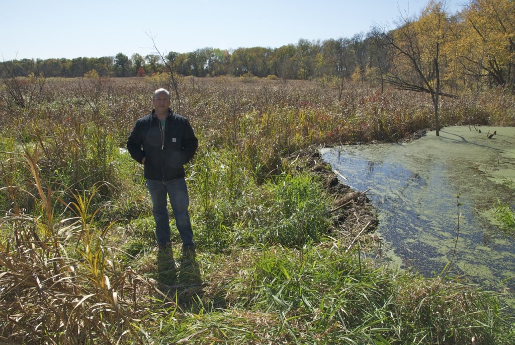
Matt Fisher, Eastern Iowa Project Director for The Nature Conservancy, in a Lower Cedar wetland at the conservation group's Maytag Tract in Muscatine County.
Written by Larry Stone
In the wide valleys where the Cedar River joins the Iowa River on its way to the Mississippi, lies a unique complex of wetlands, prairies, woodlands, and backwaters that together form a treasure of natural diversity.
Here in Muscatine and Louisa counties you'll find the rare massasauga rattlesnake and Blanding's turtle, along with 70 percent of Iowa's other reptile and amphibian species. Endangered Indiana bats live under the furrowed bark of huge swamp white oak, sycamore, and cottonwood trees. Unusual fish like the grass pickerel survive in some unpolluted streams. Sandhill cranes and American bitterns have nested in the prairie wetlands. Cerulean warblers hide in upland forests. Cardinal flowers and ladies' tresses orchids bloom in the lowlands, while prickly pear cacti and little bluestem cling to sandy ridges. All told, the variety of habitats may support 1,000 plant species.
An ecological assessment for the Upper Mississippi Basin pinpointed the lower Cedar and Iowa as an “aquatic area of biodiversity significance.” It's a fascinating ecosystem that endures in the face of dramatic changes to the surrounding agricultural landscape.
The Lower Cedar also is part of a state Amphibian and Reptile Conservation Area (ARCA) – a first-in-the-nation concept. The designation recognizes the ecological importance to reptiles and amphibians of a 450,000-acre area in the Lower Cedar, Iowa, and Mississippi corridors. The ARCA status encourages cooperative management efforts on public lands, along with voluntary easements and conservation measures on private land.
Despite its significance, the Lower Cedar remains a diamond in the rough. It's a natural area little known to most Iowans – and sometimes taken for granted by residents of the area. Some local farmers didn't consider it unusual to encounter massasauga rattlesnakes in hayfields, or to uncover turtle eggs when tilling crop fields. The region's rivers, swamps, and woodlands nurtured a long tradition of hunting and fishing – but perhaps not a realization that the Lower Cedar was an extraordinary ecosystem.
“Nobody knows this is down here,” said Matt Fisher, Eastern Iowa Project Director for The Nature Conservancy (TNC). Fisher manages the Conservancy's 1,600 acres of land in the area, which TNC calls “the most biologically diverse area in the state.”
The diversity reflects its geological history as an ancient lake, along with climatic and landscape forces that sculpted it for millennia. For example, dunes formed in places where winds whipped sand up off the lake bed. But the Lower Cedar's mix of rugged, sometimes inhospitable landforms also have helped it escape some of the pressures that have turned other parts of the Cedar into expanses of cropland or urban developments.
Nature and humans continue to shape the Lower Cedar. Some floodplain savannas, where original surveyors found only scattered trees, have become dense woodlands. Natural succession has allowed honey locusts, hackberries, mulberries, and other trees to creep in when periodic, dry-season fires were suppressed by farmers. Reed canary grass – an aggressive invader that crowds out native ground cover – is changing the mix of vegetation.
Fisher and his staff have cut trees, selectively used herbicides, and partnered with farmers to graze livestock in some conservancy preserves. The idea is to mimic natural forces – such as floods, fire, bison, beaver, and storms – that opened up the floodplains by suppressing woody vegetation.
But Fisher noted that the Lower Cedar also has been molded by its entire watershed, stretching all the way into Minnesota. More than a century of tiling, row crops replacing hay and native pastures, stream straightening, urbanization, and chemical use upstream have gradually changed the hydrology and ecology of the valley.
Following the record-breaking floods of 2008, The Nature Conservancy and other partners began using conservation practices to reestablish some of the hydrology. Initially, this means restoring wetlands and riparian areas. Over the longer term, the goal is holding water longer upstream, especially with more perennial crops and cover crops, improved soil quality and organic matter, and better erosion control on croplands.
The Conservancy and other local, state, federal, and private entities have protected about 20,000 acres of the region. Partners in the project include: private landowners; the Cedar, Muscatine, and Louisa County Conservation Boards; the U. S. Fish and Wildlife Service; the Iowa Department of Natural Resources; the Army Corps of Engineers; the Alliant Energy Foundation; Cargill; the National Fish and Wildlife Foundation; and the U. S. Department of Agriculture.
Fisher dreams of how management efforts might restore some of the valley to its pre-settlement habitat. “If we connect the pieces, we can let the natural processes happen,” he said.
Read other articles in this series.
—–
Originally published by the Cedar River Watershed Project
Learn more about watersheds and how you can protect them.