Coping with Change
By Kerri Sorrell on April 29, 2019 in Blog
Editor's note: When we started writing this story in early 2019, no one could have predicted the devastation and uncertainty floods would bring to our state early this spring. It has always been our goal to write about relevant conservation topics that bring awareness and push forward for protection and care of Iowa’s land and water, and for some this story may hit close to home. Our hearts are heavy for those impacted by floods already this year.
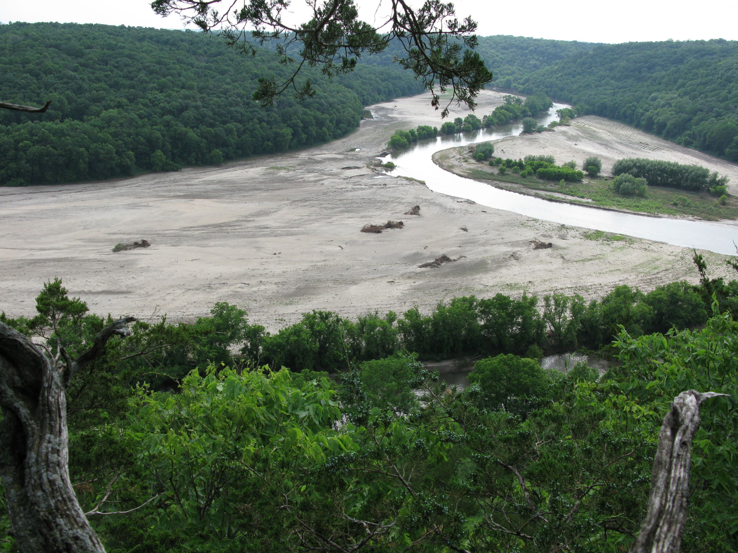
Brian Fankhauser was busy in May 2008, dreaming up visions for the newly-protected, INHF-owned Heritage Valley preserve outside Decorah. With three miles of the Upper Iowa River meandering through it, Fankhauser saw the valley as a future haven for wildlife, recreationists and scientists. That month, a 120-foot prairie buffer was planted along the river and 31,000 trees were rooted in the floodplain, taking a step toward Heritage Valley’s next chapter.
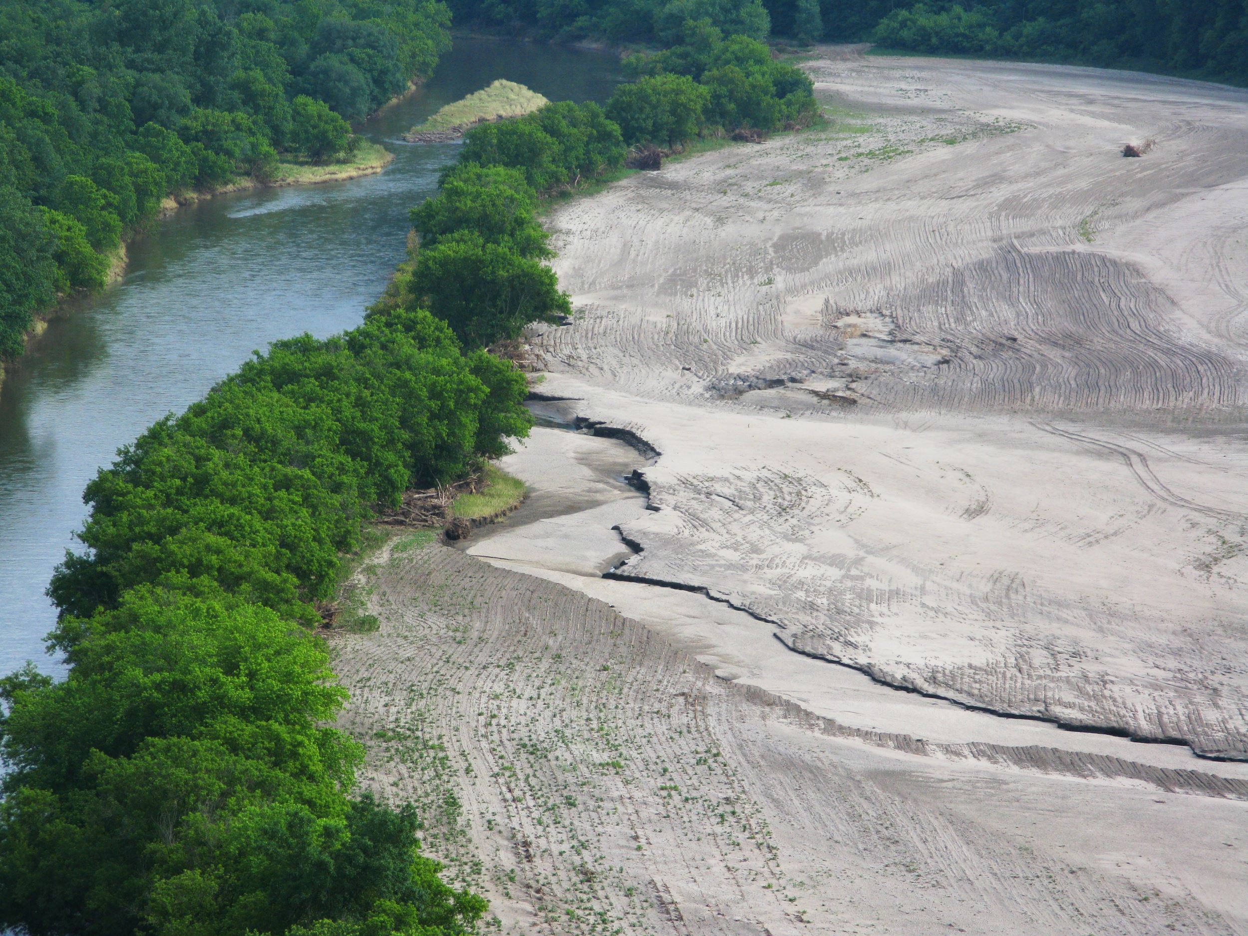
Three weeks later, one of the largest floods northeast Iowa had ever seen ripped through Heritage Valley, leveling the new plantings, cutting a new river channel through the floodplain and leaving scour holes big enough to engulf a pickup.
“When the water retreated, it looked like a moonscape,” said Fankhauser, INHF blufflands director.
What happened to Heritage Valley in 2008 may sound familiar to others: That year saw some of the most devastating floods in Iowa history. And in the decade since, the issue of flooding hasn’t seemed to subside.
“What seems fairly obvious is just how common flooding is now,” Fankhauser said. “And they’re not just small ones, we’re seeing fairly large events.”
A swelling problem
“We’ve seen floods impact our state throughout the last 10 years increasingly more so,” said Larry Weber, co-founder of the Iowa Flood Center (IFC).
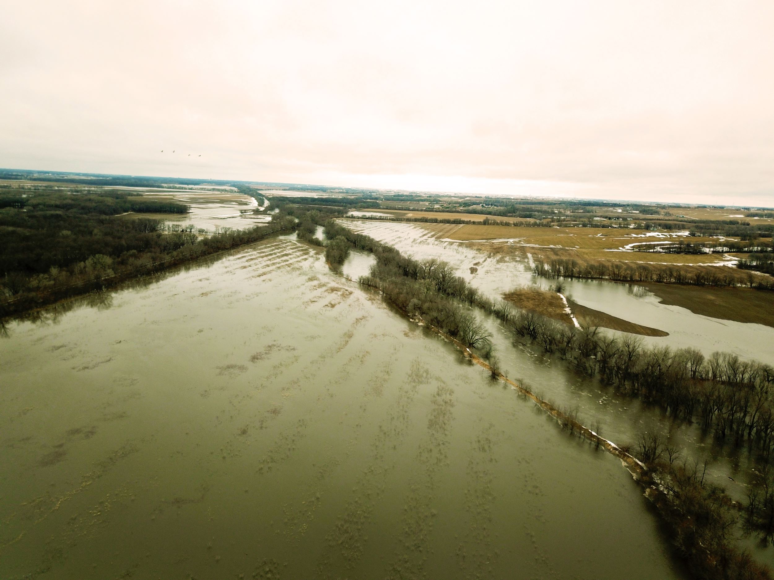
The IFC was founded in response to the 2008 floods and has been tracking flooding data and impacts across the state since. In that time, the data they’ve collected is clear: Flooding is getting worse in Iowa, with vast natural and economic impact to Iowa’s communities.
Some of the data is startling. Iowa has racked up 951 presidential disaster declarations due to flooding since just 1991, causing more than $18 billion in infrastructure, residential and crop damage in that same time. 2018 was Iowa’s second wettest year on record, with statewide average rainfall almost 10 inches above normal, according to the Iowa DNR Water Summary.
The facts bring up pressing questions for Iowa’s future: What’s causing such an increase in rainfall and flooding, and how can conservation help address the growing problem?
Large forces at play
“Iowa’s streams and rivers were pushed out of their natural equilibrium when our land was being converted from prairie and wetlands to agriculture and human development,” said Peter Levi, assistant professor of environmental science and sustainability at Drake University.
Flooding as a natural phenomenon is normal — rivers and streams adjust their flow and size based on weather patterns and the land around them. Waterways are just one part of a watershed and come with their own floodplains, land that allows for the natural filtration, dispersion and storage of water. But as development and agriculture have expanded into these floodplains, land along streams and rivers is increasingly utilized for purposes other than natural water retention, leaving nowhere for waterways to naturally flood.
“When we modify the land, we decrease the time water spends on the land, causing the water to get into streams and rivers much more quickly,” Levi said. The effect, says Levi, is an increase in flooding and pollution from nitrate and phosphorous.
“We know we’re impacting our land through land management and land use decisions, and the expansion of urban areas and urban development definitely contributes to that,” Weber said. “But probably more so through the intensification of agriculture in the last decades, and especially agricultural drainage.”
But there are even larger forces at play, ones that come with their own distinct challenges.
“As a composite, on the whole, the intensification of flooding is a definite result of climate change,” Weber says.
“As climate scientists predicted, our springs and falls are becoming wetter, our summers cooler, and we’re seeing higher dew points and moisture levels, which are driving these large rain and flood events.”
“Not only have we changed the landscape, we’ve added an additional layer of human impact with climate change,” Levi says. “We’re seeing intense rain events in shorter periods, large storm systems getting stuck as they move across the continent and a change in atmospheric conditions.”
“Floods aren’t unnatural, but the magnitude of them — the effects are amplified and more severe,” Levi said.
Seeing the effects
In Iowa, “we have to talk about water quality and quantity hand in hand,” said Jamie Benning, water quality program manager at Iowa State University Extension & Outreach.
With less natural floodplain land around our rivers and streams, water runoff from fields and developed areas is increasing in volume and speed. Chris Jones, a research engineer with IIHR – Hydroscience & Engineering (formerly Iowa Institute of Hydraulic Research), studies the effects of this increased runoff across the state.
“When you look, for example, at the Wapsipinicon River, the average flow of the river has increased 204 percent since 1934,” Jones said. “That river is on average twice as big as it was historically.
There’s a direct relationship between increase in precipitation, flow and discharge.”
And as more water runs off the land, it’s carrying a higher load of harmful pollutants with it.
“When we look at five year averages, nitrogen pollution in the state is about 70 percent higher
than it was in 2003,” Jones says. “Phosphorous pollution has increased about 40 percent since 2004.”
While the impact of flooding is felt across the state, river flow and water pollution have been increasing more rapidly in western and northeast Iowa, where land use has transitioned from year-round vegetation more dramatically than the rest of the state.
So how can the state start addressing these compounding issues? The answer lies in the land.
Natural solutions
“When we think about conservation’s role in reducing the impacts of flooding and nutrient pollution,
we’re thinking from a water retention standpoint and the natural way a floodplain should work,” said Heather Jobst, INHF senior director for land conservation. “If you have a natural, functioning river system, it holds more water. We’re always looking to bring our rivers and streams back to that more natural state.”
INHF works with landowners across the state to protect land along river corridors and restore it
to year-round natural vegetation, like grassland, prairies, wetlands, and utilize conservation-forward land management techniques, like cover crops and managed grazing. This restoration increases the land’s capacity to hold water, creating a high-functioning floodplain, natural habitat for wildlife and opportunities for recreation. Retaining surface and ground water — and having permanent roots in the soil — help decrease the speed and flow of water into Iowa’s streams and rivers.
It’s on this idea that Levi has based a majority of his work. Levi has spent three years setting up a network of stream sensors in central Iowa to study the impact of conservation land on water quality and flow. Sensors are installed in streams next to crop land, development and protected land in native vegetation, and are constantly measuring health indicators of the stream system. While still in the early stage of reporting, Levi is already seeing clear signs: Streams are healthier flowing through protected natural land than when they enter.
Levi’s results could mean big news for conservation. “As I analyze these data, I expect we’ll have a quantitative demonstration of the value of conservation land on water quality,” Levi said. “It’s very exciting.”
Finding the right pieces
But with limited resources and ever- increasing pressure on our river and stream corridors, it can be hard to know where to start with protection. A Land & Climate Program grant from the Land Trust Alliance will help INHF answer that question. The grant- funded research will overlay The Nature Conservancy’s Resilient Lands data and other Iowa conservation data to identify what lands could be most resilient in years ahead, and where conservation groups could be focusing to best combat the effects of flooding and climate change.
“We’re bringing together two very big concepts, climate change and land protection, and making it feel more solvable,” said Emily Martin, INHF conservation programs coordinator. “When you’re able to piece it down to the most important land to protect, it gives you a clear start point to addressing these issues.”
INHF will be sharing this data with watershed groups across the state working to combat the effects of flooding in their local areas. Part of the Iowa Watershed Approach (IWA), eight watershed teams are working to implement conservation and flood-prevention protection in areas along Iowa’s major river corridors.
Funded by a $97 million dollar grant from the federal government, the IWA is developing models for flood prevention for the whole state, and allowing communities and cities to collaborate to build healthier and more connected floodplains.
“The Iowa Watershed Approach attempts to deal both with our flood challenges and water quality challenges,” Weber said. “We have to think locally and how we can improve one watershed, one field, one urban lot at a time.”
By working on a watershed scale instead of on municipality or county borders, partners are more able to address flooding issues that impact every community along a river.
“Streams don’t stop at or recognize political boundaries,” says Jeff Geerts, special projects manager with the Iowa Economic Development Authority. “A watershed approach brings together cities and counties to address a flooding issue they all have in common, on a stream or watershed they all share.”
Flowing toward progress
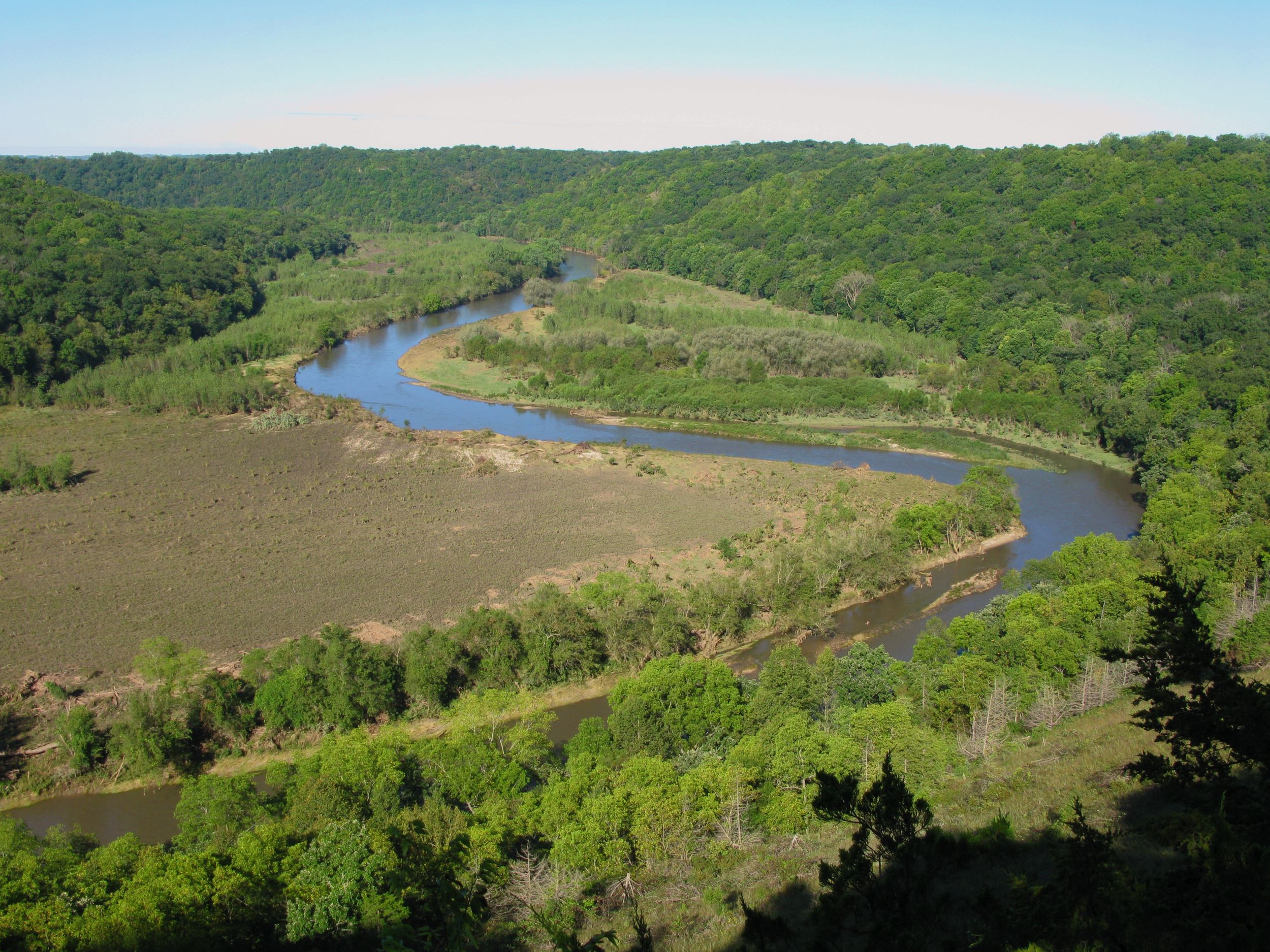
In the years after the 2008 flood, Heritage Valley has recovered. After the initial cleanup, the original floodplain area was planted back to prairie and trees, and more acres have been planted to year-round vegetation since 2012. When floods came again in 2013 and 2016 (the largest flood event the lower Upper Iowa has ever seen), Heritage Valley held. Prairie and tree roots prevented any scouring and the valley’s soil stayed in place.
It’s just one example of what the land, when given a chance, can do.
“It’s not about ‘more of this, less of that,’ it’s ‘how can conservationists, farmers and organizations work together to tackle these issues side-by- side?’ This is a state we all love and we need to protect it together,” said Joe McGovern, INHF president.
Iowa has immense challenges facing it, but with the right partnerships and dedication, a better future is attainable.
“If we can show that land conservation and the watershed approach work can improve water quality, that’s a blueprint for the rest of the agricultural Midwest,” Levi says.
“It’s time we ask ourselves: Are we going to collectively develop solutions that truly help people and lessen the impact of these events in the future? It’s going to take a lot of effort — and we’re ready to play our part,” says McGovern.