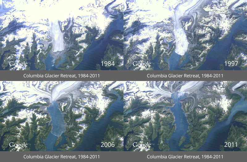
Destruction and development through time
By Kerri on May 15, 2013 in Blog

Last week, Google released several photo time-lapses that show urban development, deforestation and glacier melt in recent decades. All photos were compiled through Google Earth’s satellite imaging technology. Check all of the time-lapses here.
Which GIF surprised you the most?